PC*Miler: the Ultimate Truck Routing and Mileage Software
Enhance your TMS or build custom applications with our platform, powered by the industry standard commercial vehicle routing, mileage and mapping.
✓ Predict and reduce freight costs
✓ Optimise complex transportation plans
✓ Track, measure and report carbon emissions


Consistent data to simplify, manage and measure complex transportation costs
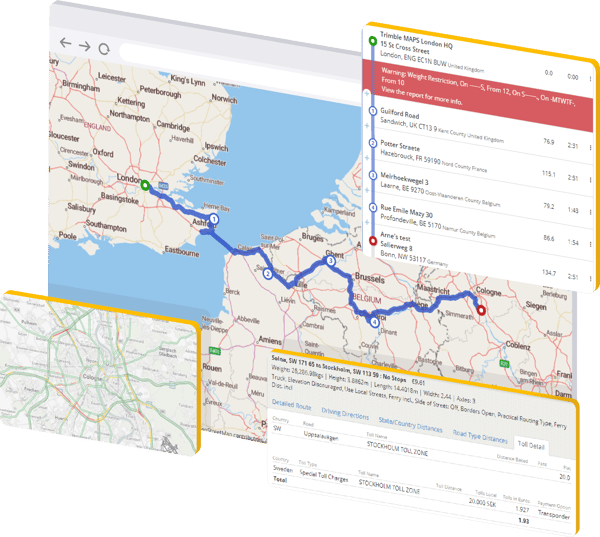
- A single point of integration for solving international distance and time calculations
- Truck and load-specific routing that takes into account vehicle dimensions, load restrictions, time and environmental restrictions.
- Multi-stop trip optimization and scheduling that takes into account time-windows
- Individual route planning and matrix calculation between multiple origins and destinations.
Routing API Documentation >
Hazmat Routing And Navigation Blog >


Accurately predict road transport costs: time and distance reports and close the gap between planned vs actual carrier costs


We partner with many of the world’s leading Transportation Management Systems (TMS), Telematics, and Fleet management systems:


DEMO
Our automated trip visibility and dynamic ETA technology
The movement of freight has become increasingly complex — from traffic to hours of services regulations, to driver breaks and dwell times. Along with the need to provide customers with reliable ETAs and asset visibility.
ARTICLE
Precision and Predictability Provide Optimal Transport Planning
In this interview, David Quin, director of strategic partnerships at Trimble Maps, discusses how robust planning solutions can help shippers and carriers work together to optimize routes and maintain the delicate balancing act between cost and speed.